Sioux Falls grew around the powerful cascade of the Big Sioux River, but its subsurface tells a more complicated story than the pink quartzite outcrops let on. Beneath the glacial till that covers much of the city, weathered Sioux Quartzite bedrock can sit just a few feet down or drop abruptly into buried paleochannels filled with compressible silts. When a cut goes deeper than 12 feet in the downtown core—say, near Phillips Avenue where the old stockyards once stood—the transition from stiff clay to fractured rock shifts how the excavation breathes. We run geotechnical excavation monitoring programs that capture those shifts in real time, tracking lateral movement, groundwater pressure, and vibration signatures that matter when you are working next to a 1910s masonry building or the active sanitary interceptor sewer that runs beneath the riverbank. A well-instrumented excavation in this city is not just a code requirement under IBC Section 3304; it is the difference between a predictable dig and a morning phone call you do not want.
Monitoring in Sioux Falls is about managing the contact between glacial till and quartzite—two materials that respond to stress on completely different time scales.
How we work
Local ground factors
A 10-story mixed-use project along the east bank of the Big Sioux—right where the river makes its sharp bend south of 6th Street—taught us more about Sioux Falls groundwater than any borehole log could. The excavation reached 22 feet into dense till, but a horizontal seam of weathered quartzite acted as an unplanned drain, piping water into the cut within two hours of exposing the rock. Without real-time piezometer data and a standby dewatering package, the base would have softened into a soup that no compaction could fix. That scenario repeats in smaller ways across the city: contractors assume the till is tight, but the rock interface can deliver surprises. We use that experience to shape trigger levels that are specific to the local geology—not copied from a generic manual—and we keep a geotechnical engineer on call who can be at the site within the hour when a reading crosses the threshold.
Relevant standards
IBC 2021 (International Building Code) – Section 3304 Excavation Safety, ASCE 7-22 – Minimum Design Loads and Geotechnical Risk Categories, OSHA 29 CFR 1926 Subpart P – Excavation and Trenching Safety, ASTM D6230 – Standard Test Method for Monitoring Ground Movement Using Probe-Type Inclinometers, USBM RI 8507 – Blasting Vibration Criteria for Historic Structures
Other technical services
Deep Excavation Instrumentation & Real-Time Monitoring
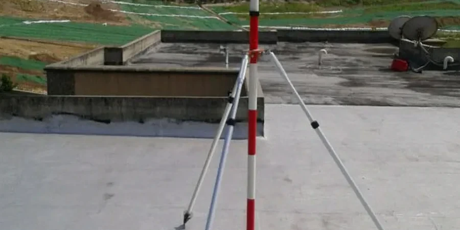
Complete monitoring arrays for shored and unshored excavations deeper than 10 ft. We install inclinometers, piezometers, load cells on tiebacks, and automated total stations with prism targets, all logged to a cloud platform with SMS alerting when deformation rate exceeds the agreed threshold. Reports include time-displacement curves, pore pressure trend analysis, and daily site condition summaries for the project file.
Vibration & Structure Response Monitoring
For excavations within 50 ft of occupied buildings, historic structures, or sensitive equipment, we deploy triaxial geophones and crack monitors with sub-millimeter resolution. Data is correlated against excavation activity logs so the team can pinpoint which operation—rock hammering, haul truck traffic, sheet pile driving—drives the response. We calibrate limits to USBM RI 8507 for plaster and masonry and to manufacturer specs for industrial floor tolerances.
Typical parameters
Common questions
What is the typical cost range for geotechnical excavation monitoring on a downtown Sioux Falls project?
For a standard 3-month monitoring program on a commercial excavation in Sioux Falls, the cost typically falls between US$920 and US$2,880 depending on the number of instrument stations, the required reporting frequency, and whether vibration monitoring for adjacent structures is included. The final scope is always tailored to the site-specific ground conditions and the risk category of the nearby buildings.
How does the weathered quartzite in Sioux Falls affect monitoring instrument selection?
The contact between glacial till and Sioux Quartzite creates a zone where inclinometer casing can be sheared if the rock is not socketed properly. We use heavy-duty ABS casing with a telescoping coupling at the till-rock interface and grout the rock socket with a low-modulus mix that permits some differential movement without kinking the casing. Piezometers are installed with a sand pack isolated by bentonite seals above and below the quartzite seam to capture pore pressure in that specific horizon.
What trigger levels do you use for stopping work on a shored excavation in Sioux Falls?
Trigger levels are site-specific, but a typical Sioux Falls program sets a green-yellow-red system. Green means deformation below 0.25 inches cumulative. Yellow—notification to the engineer—kicks in at 0.5 inches cumulative or a rate exceeding 0.05 inches per day. Red, requiring work stoppage and reassessment, activates at 1.0 inch cumulative or sudden acceleration in the deformation curve. These values are tightened when adjacent structures fall under IBC Risk Category III or IV. More info.